![[JT]](https://www.jochentopf.com/img/jtlogo.svg) Jochen Topf's Blog
Jochen Topf's Blog
More and more boundaries of administrative areas find their way into OpenStreetMap. In some countries there is already quite a lot of data for several levels of government. Unfortunately it is hard to edit and hard to use because relations must be used to model areas in OSM and relations are notoriously difficult to handle. Relations and with it the areas they represent are often broken as a result. Its therefore hard to get a complete set of administrative areas for a particular country and level of government.
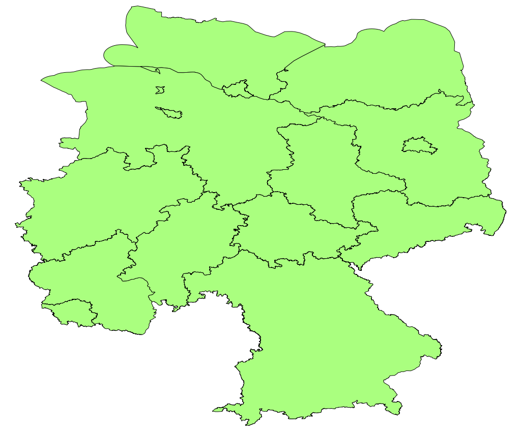
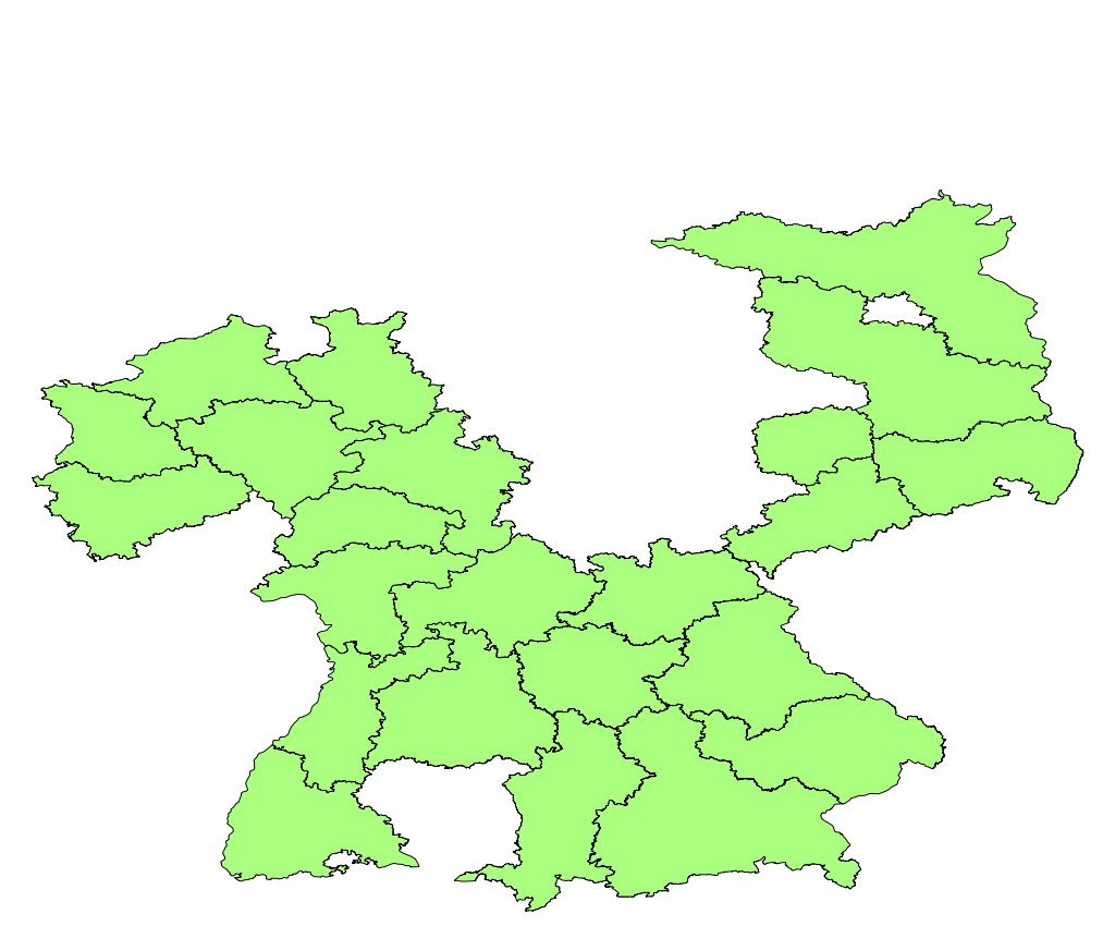
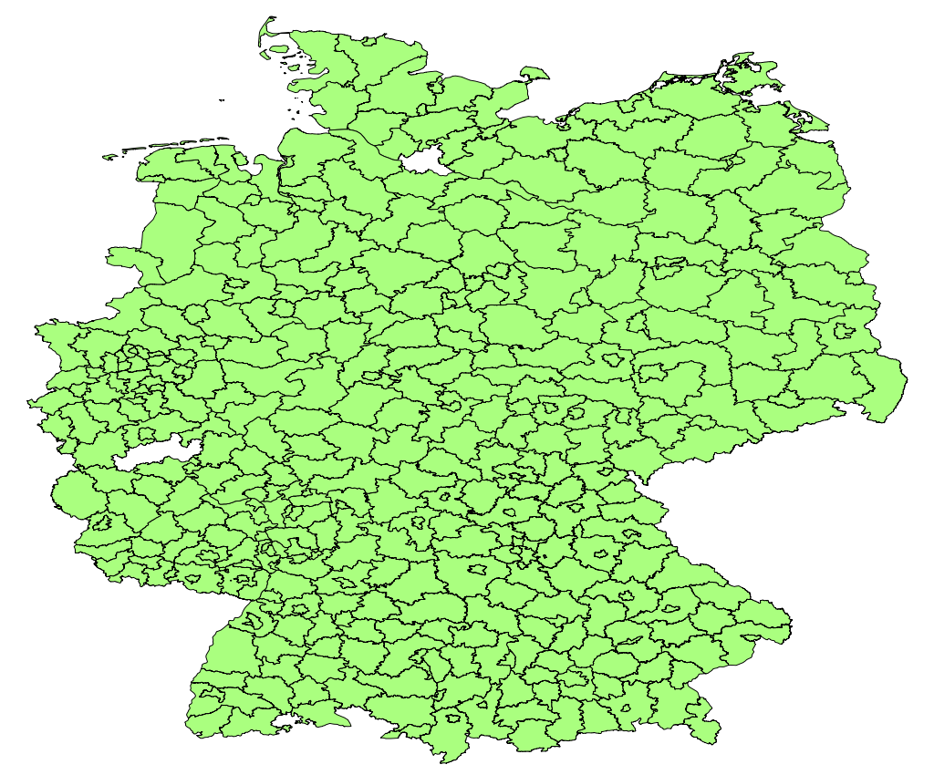
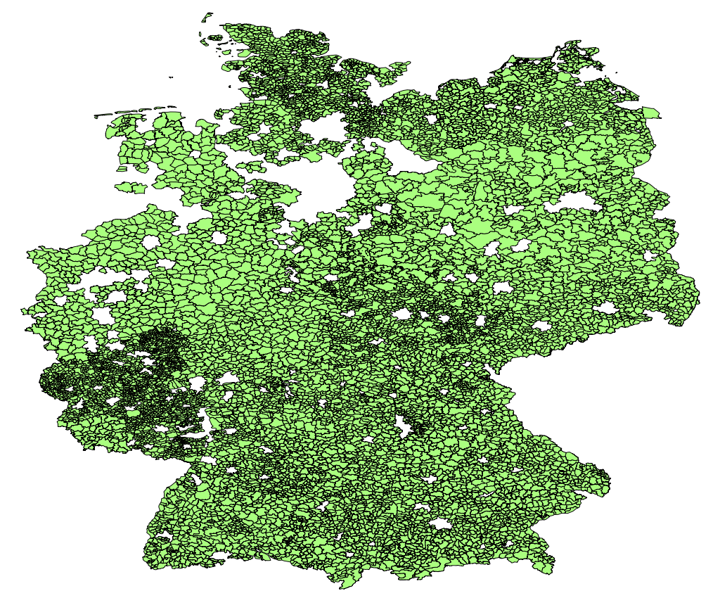
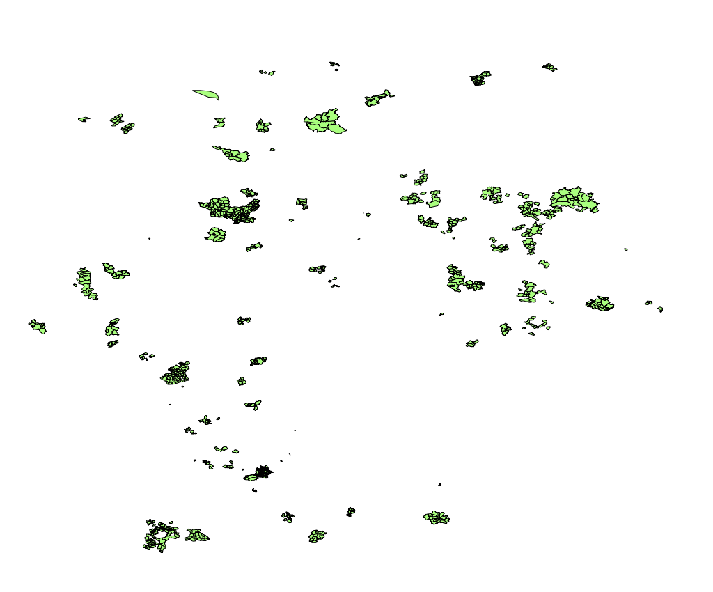
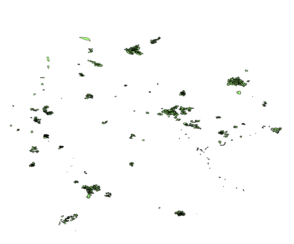
I recently had a look at the situation in Germany and created the following images which demonstrates the patchwork of boundary data in OSM. The data was taken from the Geofabrik Germany extract, valid multipolygon/boundary relations were extracted and rendered according to the admin_level tag. Note that missing data at the boundary of Germany might be due to the extract having cut out a bit more data than it should. (Click on images to see larger version.)
 |
 |
 |
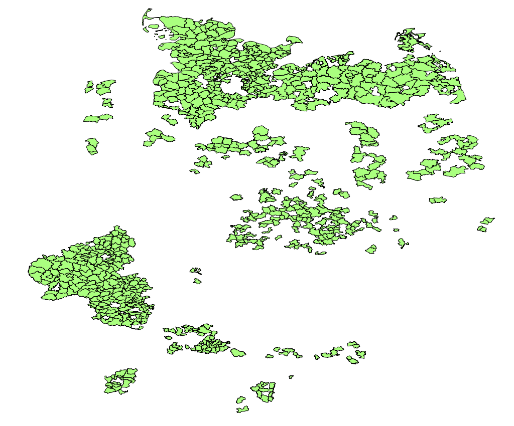 |
| admin_level=4 (Bundesländer) | admin_level=5 (Regierungsbezirke) | admin_level=6 (Kreise) | admin_level=7 (Verwaltungsgem.) |
 |
 |
 |
 |
| admin_level=8 (Stadt, Gemeinde) | admin_level=9 (Stadtbezirk) | admin_level=10 (Stadtteil) | admin_level=11 (Stadtviertel) |
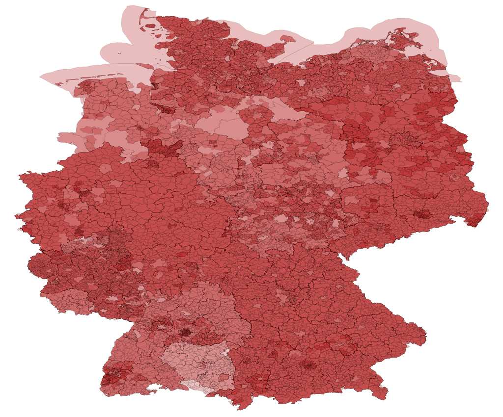
The image on the right was created by overlaying all this data into one image using a partly transparent fill. So the darker the red, the more areas are on top of each other. The result is a nice picture but doesn’t say much about the data quality. Different states (Bundesländer) have different ways of organising administrative areas in their jurisdiction. Most of the empty areas in the level5 image for instance are supposed to be empty, because there are no “Regierungsbezirke” in several states. So its unclear how much of the patchwork you see in the picture is due to real life differences and how much is due to missing or wrong data in OSM.
Tags: geodata · maps · openstreetmap · osmdata