![[JT]](https://www.jochentopf.com/img/jtlogo.svg) Jochen Topf's Blog
Jochen Topf's Blog
In the last months I have spent a lot of my spare time working on the OSMCoastline program mentioned several times in this blog already. It is by no means perfect yet, but it works and several people have tried it and used its output. But it is not the easiest program to use with all its options and you need a current planet file to work from, not everybody has one lying around. So I thought about how to make access to its output easier for everybody.
I wanted to run OSMCoastline as a service somewhere and offer its result as download. There are several places where I could have done this, such as the dev servers run by OSMF or the FOSSGIS but after working so long on the software I decided I want it on my own server. This gives me the chance to try something new and put a PayPal button on there and ask for voluntary contributions. Thats not going to make me rich, but I hope that at least some people will send some money. It would allow me to work some more on Open Source software and free services like this.
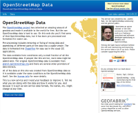
So today I am launching OpenStreetMapData.com [Update: Discontinued June 2019]. Currently it offers several variants of the data created by OSMCoastline (land polygons, water polygons, coastlines) for download, but as the name suggests I might add other data sourced from OSM, too.
I have resisted the urge to slap a BETA label on there, they have been used too much. But the site is new and there will probably be problems in the beginning. Depending on feedback from users I might also change the format of the downloads, use different parameter on OSMCoastline to generate the files etc. Tell me what you like and what you don’t!
Tags: openstreetmap · openstreetmapdata · osmcoastline