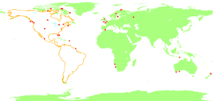
Today the April 2012 issue of the German computer magazine “iX” was in my mailbox. It contains my four and a half page article on how to create your own maps with OSM data. I describe how to use Osmium/osmjs software to extract the data and Tilemill to style and create the maps.
Tags: openstreetmap · osmium
I gave two talks at the FOSSGIS 2012 conference last week. The first, OpenStreetMap in Zahlen und Karten, was not recorded and I will not release the slides as they will be difficult to understand and easy to mis-understand without my words. I will probably re-use the content for a few blog articles here in the future.
| Read more…
Tags: conference · event · fossgis · openstreetmap · osmium · talk
Next week is the FOSSGIS conference in Dessau. I’ll be speaking there about OpenStreetMap in Zahlen und Karten and Das Osmium-Framework. Together with Tim Alder I am also organising a community session to discuss the Wikipedia Multilingual Maps Project. See you in Dessau!
Tags: conference · event · fossgis · multilingual maps · openstreetmap · osmium · rendering · talk

Every map of the world has to take into account that there are land areas and water areas. You could have huge polygons for each continent and paint them on a blue background. But handling those huge polygons is difficult. OpenStreetMap solves this problem by having ways tagged with “natural=coastline” and the convention that the land is always on the left side of this way. So a continent or an island is surrounded by one or more ways in counter-clockwise order. It is much easier to edit those coastlines instead of large multipolygon relations or something like it. Coastlines are the only case where OSM has this special rule.
| Read more…
Tags: openstreetmap · osmcoastline · osmdata · osmium
![[JT]](https://www.jochentopf.com/img/jtlogo.svg)
